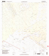
1995 Map of Kalalua
USGS Topo · Published 2004About this map
Hawaii Volcanoes National Park and the East Rift Zone dominate this mid-1990s survey of the Puna District. The landscape is defined by successive layers of volcanic activity, including the Lava Flow of 1961, Lava Flow of 1969, and Lava Flow of 1977, which have reshaped the terrain around Kalalua and Puu Kahaualea. These flows intersect with established conservation lands such as the Wao Kele O Puna Natural Area Reserve and the Puna Forest Reserve. To the northeast, the grid of Kea Au and Waikahekahe Iki shows a developing residential pattern with streets named for local flora and fauna like Ahi Street, Alani Street, and Lehua Street. The map captures the intersection of recent geologic change and human settlement at the Kupahua Homesteads and Kaimu-Makena Homesteads.
Find a feature on this map
54 named features on this map. Tap any name to fly to it.
Don’t see what you’re looking for? This feature index may not catch every label — zoom into the map to look around manually.
Map Details
Editions of this 1995 Kalalua Map
2 editions found
Other maps of this area

1917 · Hilo
USGS Topo · 1:62,500

1922 · Puna
USGS Topo · 1:62,500

1924 · Makuu
USGS Topo · 1:62,500

1924 · Puna
USGS Topo · 1:62,500

1924 · Kalapana
USGS Topo · 1:62,500

1932 · Hilo
USGS Topo · 1:62,500

1954 · Hawaii South
USGS Topo · 1:250,000

1954 · Hawaii North
USGS Topo · 1:250,000

1959 · Hawaii South
USGS Topo · 1:250,000

1959 · Hawaii North
USGS Topo · 1:250,000