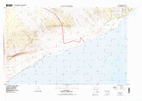
1994 Map of Kalapana
USGS Topo · Published 1998About this map
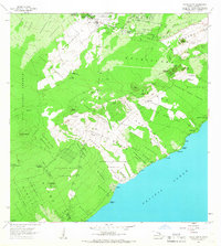
Hawaii Volcanoes National Park dominates this coastal landscape, where the volatile intersection of volcanic activity and human settlement is clearly etched. The map documents significant geologic transformations, including the Lava Flow of 1977 and the Lava Flow of 1750, which have reshaped the Puna district over centuries. These flows define the surroundings of Kalapana and Kaimu, once-thriving communities near the coast. Along the shoreline, landmarks such as Harry K Brown Park and Kaimu Beach Park appear alongside the culturally significant Cave of Refuge (Hakuma). The transit network is represented by the winding Chain of Craters Road and the Coast Trail, which navigate the steep descent of Holei Pali toward the Pacific Ocean. Numerous homestead regions, including the Kupahua Homesteads and Kikala-Keakea Homesteads, illustrate the division of land in this dynamic environment.
Find a feature on this map
43 named features on this map. Tap any name to fly to it.
Don’t see what you’re looking for? This feature index may not catch every label — zoom into the map to look around manually.
Map Details
Editions of this 1994 Kalapana Map
2 editions found
Other maps of this area

1922 · Puna
USGS Topo · 1:62,500

1924 · Puna
USGS Topo · 1:62,500

1924 · Kalapana
USGS Topo · 1:62,500

1954 · Hawaii South
USGS Topo · 1:250,000

1959 · Hawaii South
USGS Topo · 1:250,000

1961 · Hawaii South
USGS Topo · 1:250,000

1962 · Hawaii South
USGS Topo · 1:250,000
1963 · Volcano
USGS Topo · 1:24,000
1963 · Makaopuhi Crater
USGS Topo · 1:24,000
1966 · Pahoa South
USGS Topo · 1:24,000