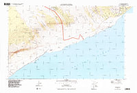
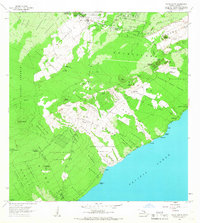
1994 Map of Kalapana
USGS Topo · Published 1998About this map
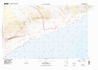
The coastal landscapes of the Puna District are shown during a period of significant volcanic transformation in the mid-1990s. The map illustrates the dominance of volcanic activity over human settlement, clearly marking the Lava Flow of 1977 and the ancient Lava Flow of 1750 as they reached the Pacific Ocean. This 1994 imagery update provides an essential record of the region within Hawaii Volcanoes National Park, documenting how recent eruptions have altered the path of the Chain of Craters Road and the Puna Coast Trail.
Find a feature on this map
39 named features on this map. Tap any name to fly to it.
Don’t see what you’re looking for? This feature index may not catch every label — zoom into the map to look around manually.
Map Details
Editions of this 1994 Kalapana Map
2 editions found
Other maps of this area

1922 · Puna
USGS Topo · 1:62,500

1924 · Puna
USGS Topo · 1:62,500

1924 · Kalapana
USGS Topo · 1:62,500

1954 · Hawaii South
USGS Topo · 1:250,000

1959 · Hawaii South
USGS Topo · 1:250,000

1961 · Hawaii South
USGS Topo · 1:250,000

1962 · Hawaii South
USGS Topo · 1:250,000
1963 · Volcano
USGS Topo · 1:24,000
1963 · Makaopuhi Crater
USGS Topo · 1:24,000
1966 · Pahoa South
USGS Topo · 1:24,000