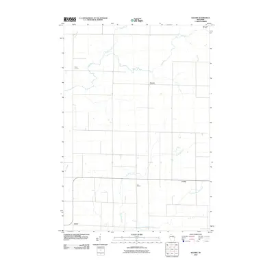
2010 Map of Kalinke
USGS Topo · Published 2010About this map
The Trappe River meanders across the northern portion of this landscape, carving through a region defined by its rural intersections and scattered agricultural settlements. The small community of Glandon sits centrally among these river bends, while further south, Kalinke marks a prominent local crossroads. This 2010 survey illustrates a well-ordered grid of country roads that connect these quiet outposts with outlying areas like Sunset.
Find a feature on this map
12 named features on this map. Tap any name to fly to it.
Don’t see what you’re looking for? This feature index may not catch every label — zoom into the map to look around manually.
Map Details
Editions of this 2010 Kalinke Map
This is the sole edition of this map. No revisions or reprints were ever made.
Other maps of this area

1899 · Wausau
USGS Topo · 1:125,000

1902 · Wausau
USGS Topo · 1:125,000

1951 · Doering
USGS Topo · 1:48,000

1951 · Merrill
USGS Topo · 1:48,000

1953 · Wausau
USGS Topo · 1:48,000

1953 · Hatley
USGS Topo · 1:48,000

1954 · Iron Mountain
USGS Topo · 1:250,000

1955 · Green Bay
USGS Topo · 1:250,000

1959 · Iron Mountain
USGS Topo · 1:250,000
1963 · Wausau East
USGS Topo · 1:24,000