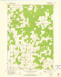
1973 Map of Kalinke
USGS Topo · Published 1976About this map
Glandon and Kalinke anchor this rural northern Wisconsin landscape during the early 1970s, where the borders of Marathon, Lincoln, and Langlade counties converge. The terrain is defined by the winding paths of the Trappe River and Big Sandy Creek, with the Ackley State Wildlife Areas occupying the northern wetland reaches. Local life is centered around institutions such as Zion Ch, Trinity Cem, and the Hewitt Texas Sch, reflecting a long-standing agricultural and timber-based community structure. The presence of a Quarry near Granite Rd and the prominent Rocky Ridge to the west suggests the underlying geological character that influenced early road placement and land use. A dense network of local routes, including Trap 18 Road and Sunrise Road, connects these dispersed settlements and family landmarks.
Find a feature on this map
46 named features on this map. Tap any name to fly to it.
Don’t see what you’re looking for? This feature index may not catch every label — zoom into the map to look around manually.
Map Details
Editions of this 1973 Kalinke Map
This is the sole edition of this map. No revisions or reprints were ever made.
Other maps of this area

1899 · Wausau
USGS Topo · 1:125,000

1902 · Wausau
USGS Topo · 1:125,000

1951 · Doering
USGS Topo · 1:48,000

1951 · Merrill
USGS Topo · 1:48,000

1953 · Wausau
USGS Topo · 1:48,000

1953 · Hatley
USGS Topo · 1:48,000

1954 · Iron Mountain
USGS Topo · 1:250,000

1955 · Green Bay
USGS Topo · 1:250,000

1959 · Iron Mountain
USGS Topo · 1:250,000
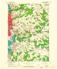
1963 · Wausau East
USGS Topo · 1:24,000