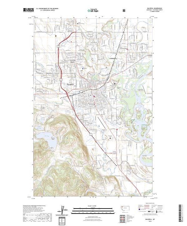
2024 Map of Kalispell
USGS Topo · Published 2024About this map
Kalispell serves as the focal point of this survey, where the urban grid meets the complex hydrology of the Flathead Valley. The landscape is defined by the convergence of the Stillwater River, Whitefish River, and Ashley Creek, which wind through the valley floor near the eastern boundary of the Flathead National Forest. This modern layout illustrates the city's role as a regional hub, featuring critical infrastructure such as the Flathead County Justice Center and the Flathead Valley Community College campus.
Find a feature on this map
42 named features on this map. Tap any name to fly to it.
Don’t see what you’re looking for? This feature index may not catch every label — zoom into the map to look around manually.
Map Details
Editions of this 2024 Kalispell Map
This is the sole edition of this map. No revisions or reprints were ever made.
Other maps of this area

1943 · Kalispell
USGS Topo · 1:125,000

1957 · Kalispell
USGS Topo · 1:250,000

1960 · Kalispell
USGS Topo · 1:250,000

1961 · Kalispell
USGS Topo · 1:250,000

1962 · Kila
USGS Topo · 1:24,000

1962 · Columbia Falls South
USGS Topo · 1:24,000

1962 · Rose Crossing
USGS Topo · 1:24,000

1962 · Blue Grass Ridge
USGS Topo · 1:24,000

1962 · Lion Mountain
USGS Topo · 1:24,000

1962 · Somers
USGS Topo · 1:24,000