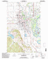
1994 Map of Kalispell
USGS Topo · Published 1997About this map
Kalispell sits at the confluence of the Stillwater River and Whitefish River as they move toward the Flathead River, serving as a regional hub for education, medicine, and government during the mid-1990s. The city's social history is anchored by the Conrad Mansion and the extensive grounds of the Conrad Memorial Cem, while the Burlington Northern line cuts through the town center, reflecting its long-standing rail dependency. The surrounding landscape is a mix of conservation and rural life, featuring the Lone Pine State Park to the west and working lands like the Silver Buckle Ranch. Significant infrastructure, including the Flathead Valley Community College and the Kalispell Municipal Airport, highlights the area's growth beyond its timber and agricultural roots. To the east, Evergreen occupies the lowlands between the rivers, showing the dense residential expansion adjacent to the Stillwater Wildlife Management Area.
Find a feature on this map
76 named features on this map. Tap any name to fly to it.
Don’t see what you’re looking for? This feature index may not catch every label — zoom into the map to look around manually.
Map Details
Editions of this 1994 Kalispell Map
This is the sole edition of this map. No revisions or reprints were ever made.
Other maps of this area

1943 · Kalispell
USGS Topo · 1:125,000

1957 · Kalispell
USGS Topo · 1:250,000

1960 · Kalispell
USGS Topo · 1:250,000

1961 · Kalispell
USGS Topo · 1:250,000

1962 · Kila
USGS Topo · 1:24,000

1962 · Columbia Falls South
USGS Topo · 1:24,000

1962 · Rose Crossing
USGS Topo · 1:24,000

1962 · Blue Grass Ridge
USGS Topo · 1:24,000

1962 · Lion Mountain
USGS Topo · 1:24,000

1962 · Somers
USGS Topo · 1:24,000