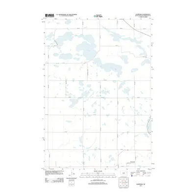
2012 Map of Kampeska
USGS Topo · Published 2012About this map
McKillicans Lake and a series of smaller prairie basins dominate this Codington County landscape, showcasing the complex hydrography characteristic of the glacial pothole region. The settlement of Kampeska sits at the southern edge of the quadrangle, where the grid of rural roads meets the northern shoreline of Lake Kampeska. The map illustrates a strictly organized section-line road system, including Horseshoe Lake Rd and Medicine Lake Dr, which weave around prominent water bodies like Horseshoe Lake and Medicine Lake. This 2012 survey by the U.S. Geological Survey provides a precise view of the interface between agricultural section lines and the natural clustering of water at Chain of Lakes and Cooley Lake. Researchers can trace the development of lakeside infrastructure along the northwestern edge of the larger lake basin.
Find a feature on this map
26 named features on this map. Tap any name to fly to it.
Don’t see what you’re looking for? This feature index may not catch every label — zoom into the map to look around manually.
Map Details
Editions of this 2012 Kampeska Map
This is the sole edition of this map. No revisions or reprints were ever made.
Other maps of this area

1953 · Milbank
USGS Topo · 1:250,000

1953 · Watertown
USGS Topo · 1:250,000

1958 · Milbank
USGS Topo · 1:250,000

1958 · Watertown
USGS Topo · 1:250,000

1969 · Watertown West
USGS Topo · 1:24,000

1969 · Pelican Lake
USGS Topo · 1:24,000

1970 · Still Lake
USGS Topo · 1:24,000

1973 · Florence
USGS Topo · 1:24,000

1973 · Wallace
USGS Topo · 1:24,000
1973 · Henry
USGS Topo · 1:24,000