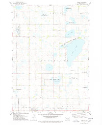
1973 Map of Henry
USGS Topo · Published 1978About this map
The town of Henry serves as the focal point of this 1970s landscape, situated along the tracks of the Chicago and North Western railroad near the southern edge of the quadrangle. This prairie region in Codington and Clark counties is defined by its extensive wetland management, featuring numerous conservation sites such as the National Waterfowl Production Area and the Long Lake State Public Shooting Area. These areas surround significant water bodies like Long Lake, Stink Lake, and the marshy Blythe Slough. Local history is anchored by rural landmarks including Graceland Ch and its accompanying Graceland Ch Cem in the northwest, alongside smaller named localities like Lorinda and Boyd. The map illustrates a transitional period of agricultural land use and dedicated wildlife preservation, with scattered Gravel Pits and a central Townhall marking the community structure.
Find a feature on this map
31 named features on this map. Tap any name to fly to it.
Don’t see what you’re looking for? This feature index may not catch every label — zoom into the map to look around manually.
Map Details
Editions of this 1973 Henry Map
This is the sole edition of this map. No revisions or reprints were ever made.
Other maps of this area

1953 · Milbank
USGS Topo · 1:250,000

1953 · Watertown
USGS Topo · 1:250,000

1958 · Milbank
USGS Topo · 1:250,000

1958 · Watertown
USGS Topo · 1:250,000

1973 · Florence
USGS Topo · 1:24,000

1973 · Wallace
USGS Topo · 1:24,000

1973 · Heggs Lake
USGS Topo · 1:24,000

1973 · Garden City
USGS Topo · 1:24,000
1973 · Kampeska
USGS Topo · 1:24,000

1973 · Naples
USGS Topo · 1:24,000