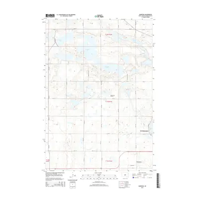
2015 Map of Kampeska
USGS Topo · Published 2015About this map
The glacial highlands of the Coteau des Prairies dominate this landscape, characterized by a complex network of wetlands and prominent water bodies. In the northwest, Medicine Lake and the Horseshoe Lake system illustrate the region's typical prairie pothole topography. The eastern edge of the survey captures the western expansion of Watertown, where residential developments like Kampeska have grown along the shores of Lake Kampeska. Transport throughout this rural portion of Codington County relies on a rigid section-line grid, including routes such as Medicine Lake Dr and Kampeska Dr, which connect these lakeside communities to the surrounding agricultural plains. The map also traces the Chain of Lakes in the northeast, highlighting the interconnected nature of the drainage patterns in this terminal moraine environment.
Find a feature on this map
32 named features on this map. Tap any name to fly to it.
Don’t see what you’re looking for? This feature index may not catch every label — zoom into the map to look around manually.
Map Details
Editions of this 2015 Kampeska Map
This is the sole edition of this map. No revisions or reprints were ever made.
Other maps of this area

1953 · Milbank
USGS Topo · 1:250,000

1953 · Watertown
USGS Topo · 1:250,000

1958 · Milbank
USGS Topo · 1:250,000

1958 · Watertown
USGS Topo · 1:250,000

1969 · Watertown West
USGS Topo · 1:24,000

1969 · Pelican Lake
USGS Topo · 1:24,000

1970 · Still Lake
USGS Topo · 1:24,000

1973 · Florence
USGS Topo · 1:24,000

1973 · Wallace
USGS Topo · 1:24,000
1973 · Henry
USGS Topo · 1:24,000