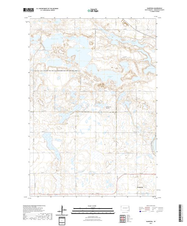
2021 Map of Kampeska
USGS Topo · Published 2021About this map
The serpentine curves of the Mississippi River dominate this 1920 landscape, carving out Lucas Bend, Medley Bend, and Angelo Bend along the border of Kentucky and Missouri. The bustling town of Columbus sits atop the heights, overlooking the river near the Iron Banks and Columbus Bluff. Further inland, a network of rural communities like Holloway, Laketon, and Burkley are connected by the tracks of the Mobile and Ohio R R and the Chicago Memphis and Gulf R R. For genealogists, the map is a vital resource for locating rural landmarks, documenting several houses of worship such as Pleasant Hill Ch, Mt Pleasant Ch, and Wesley Chapel. Family historians can also find the Davis Cem, Jordan Cem, and Toons Cem, providing precise locations for ancestral research in this riverfront region.
Find a feature on this map
29 named features on this map. Tap any name to fly to it.
Don’t see what you’re looking for? This feature index may not catch every label — zoom into the map to look around manually.
Map Details
Editions of this 2021 Kampeska Map
This is the sole edition of this map. No revisions or reprints were ever made.
Other maps of this area

1953 · Milbank
USGS Topo · 1:250,000

1953 · Watertown
USGS Topo · 1:250,000

1958 · Milbank
USGS Topo · 1:250,000

1958 · Watertown
USGS Topo · 1:250,000

1969 · Watertown West
USGS Topo · 1:24,000

1969 · Pelican Lake
USGS Topo · 1:24,000

1970 · Still Lake
USGS Topo · 1:24,000

1973 · Florence
USGS Topo · 1:24,000

1973 · Wallace
USGS Topo · 1:24,000
1973 · Henry
USGS Topo · 1:24,000