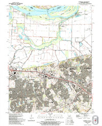
1994 Map of Kampville
USGS Topo · Published 1995About this map
The Mississippi River and its intricate riverfront geography define this portion of the Missouri-Illinois border, where river islands like Two Branch Island and Apple Island are separated from the mainland by narrow sloughs. On the Missouri side, the landscape transitions from the low-lying agricultural flats protected by levee systems around Kampville and Seeburger to the rapidly expanding suburban corridors of St Peters and St Charles. The presence of the Golden Eagle Ferry and historical landings such as McCann Landing and Fruitland Landing highlight the enduring importance of river transit in this region.
Find a feature on this map
59 named features on this map. Tap any name to fly to it.
Don’t see what you’re looking for? This feature index may not catch every label — zoom into the map to look around manually.
Map Details
Editions of this 1994 Kampville Map
This is the sole edition of this map. No revisions or reprints were ever made.
Other maps of this area

1903 · O'Fallon
USGS Topo · 1:125,000

1924 · Robertson
USGS Topo · 1:24,000

1927 · St. Charles
USGS Topo · 1:62,500

1931 · Brussels
USGS Topo · 1:62,500

1932 · Manchester NE
USGS Topo · 1:24,000

1933 · Creve Coeur
USGS Topo · 1:24,000

1933 · Saint Charles
USGS Topo · 1:62,500

1937 · Weldon Spring
USGS Topo · 1:24,000

1939 · Brussels
USGS Topo · 1:62,500

1940 · Weldon Spring
USGS Topo · 1:24,000