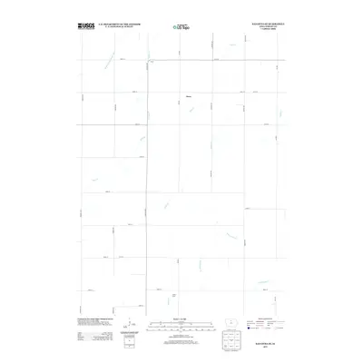
2013 Map of Kanawha SE
USGS Topo · Published 2013About this map
Agricultural operations and water management define this Wright County landscape, anchored by small rural points of interest such as Bruce and Drew. The terrain is shaped by a sophisticated network of waterways designed to drain the fertile Iowa prairie, including the substantial Drainage Ditch Number 107 and Ditch Number 36. These engineered features complement the natural winding courses of Otter Cr and Eagle Cr, which traverse the section-line grid of the local road system. The presence of Sebby Farm illustrates the continued importance of specific family-named agricultural sites within this region. Researchers of North Central Iowa will find a landscape that remains primarily dedicated to large-scale farming, where the interaction between the historic prairie wetlands and modern drainage projects is clearly visible through the numerous creeks and ditches that cut across the orthogonal road network.
Find a feature on this map
26 named features on this map. Tap any name to fly to it.
Don’t see what you’re looking for? This feature index may not catch every label — zoom into the map to look around manually.
Map Details
Editions of this 2013 Kanawha SE Map
This is the sole edition of this map. No revisions or reprints were ever made.
Other maps of this area

1954 · Waterloo
USGS Topo · 1:250,000

1955 · Waterloo
USGS Topo · 1:250,000

1972 · Kanawha SE
USGS Topo · 1:24,000

1972 · Cornelia
USGS Topo · 1:24,000

1972 · Corwith
USGS Topo · 1:24,000

1972 · Kanawha
USGS Topo · 1:24,000

1972 · Olaf
USGS Topo · 1:24,000

1972 · Renwick
USGS Topo · 1:24,000

1978 · Holmes
USGS Topo · 1:24,000

1978 · Clarion
USGS Topo · 1:24,000