
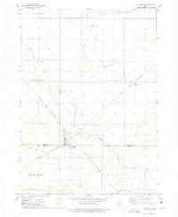
1972 Map of Renwick
USGS Topo · Published 1975About this map
Renwick serves as the primary hub of this north-central Iowa landscape during the early 1970s, situated at the junction of the Chicago and North Western railroad and several regional roads. The town's local infrastructure is well-defined, featuring the Boone Valley Sch, a Renwick Landing Strip, and Sewage Disposal Ponds. The terrain is shaped by the meandering Boone River, which flows past Smith Park and Oakdale Park, and is further defined by Prairie Creek and Otter Creek.
Find a feature on this map
24 named features on this map. Tap any name to fly to it.
Don’t see what you’re looking for? This feature index may not catch every label — zoom into the map to look around manually.
Map Details
Editions of this 1972 Renwick Map
This is the sole edition of this map. No revisions or reprints were ever made.
Other maps of this area

1923 · Fort Dodge
USGS Topo · 1:62,500

1954 · Waterloo
USGS Topo · 1:250,000

1954 · Fort Dodge
USGS Topo · 1:250,000

1955 · Waterloo
USGS Topo · 1:250,000

1957 · Fort Dodge
USGS Topo · 1:250,000

1958 · Fort Dodge
USGS Topo · 1:250,000

1972 · Kanawha SE
USGS Topo · 1:24,000

1972 · Corwith
USGS Topo · 1:24,000

1972 · Kanawha
USGS Topo · 1:24,000
1972 · Lu Verne
USGS Topo · 1:24,000