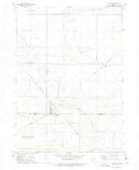
1972 Map of Lu Verne
USGS Topo · Published 1975About this map
Lu Verne straddles the county line in this early 1970s landscape, serving as a hub for the Chicago and North Western railway. The town is situated at the convergence of several rural townships including Luverne, Sherman, and Vernon. The topography is defined by an extensive network of water management, with Drainage Ditch No 117 and Drainage Ditch No 116 channeling water through the agricultural fields toward Prairie Creek. Outside the main town site, small railroad stops and settlements like Hanna and Hefty appear along the tracks. Local industry and infrastructure are represented by Gravel Pits north of town and a prominent Radio Tower on the western edge of the village. The map provides a detailed view of the sectional road grid and the quiet, engineered waterways that supported North Central Iowa's farming economy during this era.
Find a feature on this map
21 named features on this map. Tap any name to fly to it.
Don’t see what you’re looking for? This feature index may not catch every label — zoom into the map to look around manually.
Map Details
Editions of this 1972 Lu Verne Map
This is the sole edition of this map. No revisions or reprints were ever made.
Other maps of this area

1954 · Fairmont
USGS Topo · 1:250,000

1954 · Mason City
USGS Topo · 1:250,000

1954 · Waterloo
USGS Topo · 1:250,000

1954 · Fort Dodge
USGS Topo · 1:250,000

1955 · Waterloo
USGS Topo · 1:250,000

1957 · Fort Dodge
USGS Topo · 1:250,000

1957 · Mason City
USGS Topo · 1:250,000

1958 · Mason City
USGS Topo · 1:250,000

1958 · Fort Dodge
USGS Topo · 1:250,000

1958 · Fairmont
USGS Topo · 1:250,000