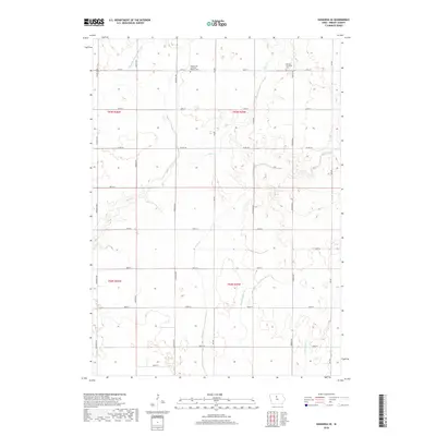
2018 Map of Kanawha SE
USGS Topo · Published 2018About this map
Agricultural patterns in Wright County are defined by a grid-like network of rural roads and a system of engineered waterways designed to manage the Iowa prairie. Central to this landscape are Otter Creek and Eagle Creek, which are supplemented by human-made infrastructure like Drainage Ditch Number 107 and Ditch Number 36. These water management features are indicative of the intensive land use required for high-yield farming in the region. Local heritage is preserved in quiet corners of the township, notably at the Norway Township Cemetery and the Wright City Christian Reform Cemetery. The map reflects the rectilinear Public Land Survey System, with prominent section lines marked by thoroughfares such as County Road C26 and Franklin Avenue, maintaining the organized settlement pattern established in the nineteenth century.
Find a feature on this map
31 named features on this map. Tap any name to fly to it.
Don’t see what you’re looking for? This feature index may not catch every label — zoom into the map to look around manually.
Map Details
Editions of this 2018 Kanawha SE Map
This is the sole edition of this map. No revisions or reprints were ever made.
Other maps of this area

1954 · Waterloo
USGS Topo · 1:250,000

1955 · Waterloo
USGS Topo · 1:250,000

1972 · Kanawha SE
USGS Topo · 1:24,000

1972 · Cornelia
USGS Topo · 1:24,000

1972 · Corwith
USGS Topo · 1:24,000

1972 · Kanawha
USGS Topo · 1:24,000

1972 · Olaf
USGS Topo · 1:24,000

1972 · Renwick
USGS Topo · 1:24,000

1978 · Holmes
USGS Topo · 1:24,000

1978 · Clarion
USGS Topo · 1:24,000