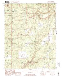
1985 Map of Kane Gulch
USGS Topo · Published 1985About this map
Natural Bridges National Monument anchors the northwestern corner of this high desert terrain, where deep drainage systems carve through the Grand Gulch Plateau. The landscape is defined by its complex hydrology, with White Canyon and Grand Gulch cutting significant paths across the southeastern portion of the Manti-La Sal National Forest. Evidence of cattle ranching and early travel is found in the naming of level areas such as Mormon Flat, Harmony Flat, and Indian Park. The transition from the plateau down to Cedar Mesa is marked by sharp topographic shifts, including the distinct formations of Sphinx Rock and the narrow corridor of Tuwa Canyon. Local resources are noted by solitary features like Maverick Spring and named landmarks such as Maverick Point and Step Point.
Find a feature on this map
20 named features on this map. Tap any name to fly to it.
Don’t see what you’re looking for? This feature index may not catch every label — zoom into the map to look around manually.
Map Details
Editions of this 1985 Kane Gulch Map
2 editions found
Other maps of this area

1886 · Henry Mountains
USGS Topo · 1:250,000

1886 · Abajo
USGS Topo · 1:250,000

1892 · Abajo
USGS Topo · 1:250,000

1892 · Henry Mountains
USGS Topo · 1:250,000

1893 · Abajo
USGS Topo · 1:250,000

1935 · Elk Ridge
USGS Topo · 1:96,000

1940 · Elk Ridge
USGS Topo · 1:125,000

1952 · Natural Bridges
USGS Topo · 1:62,500

1954 · White Canyon 4 NE
USGS Topo · 1:24,000

1954 · White Canyon 4 SE
USGS Topo · 1:24,000