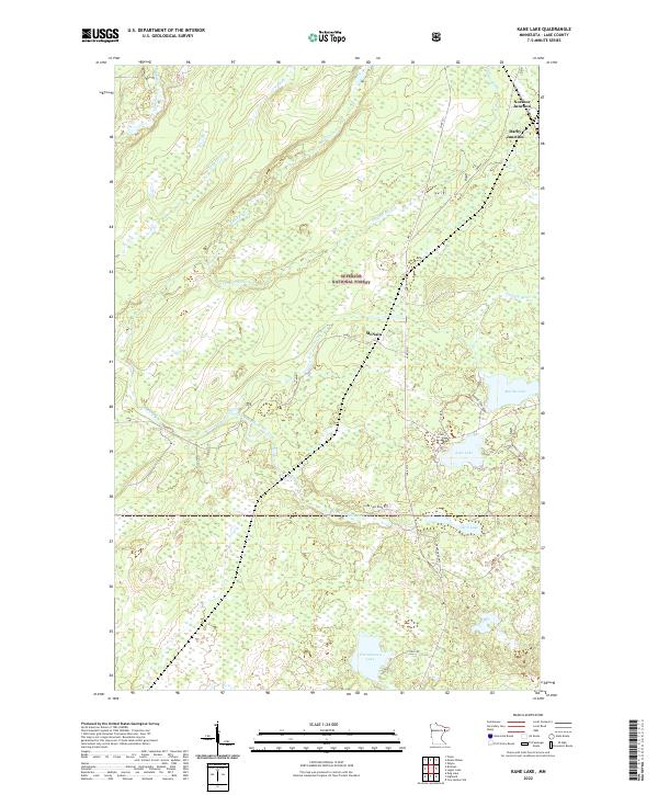
2022 Map of Kane Lake
USGS Topo · Published 2022About this map
Superior National Forest encompasses this stretch of Lake County, where a network of forest roads and small junctions provides access to a landscape defined by glacial lakes and winding waterways. The settlement of McNair sits centrally near the Langley River, while further north, the rail-oriented origins of the area are reflected in Norshor Junction and Darby Junction. This modern survey illustrates the persistent rural character of the region, where drainage patterns from Murphy Cr and Trappers Cr feed into larger arteries like the Cloquet River. Cultural markers of previous eras remain visible in the road network, such as the Abandoned Hwy and tracks leading toward high points like Marble Lake Tower Rd. Local history is anchored by family-named water bodies including Christianson Lake and Clark Lake, which, along with the larger Kane Lake, have long served as primary geographic landmarks in this timber and recreation-rich territory.
Find a feature on this map
33 named features on this map. Tap any name to fly to it.
Don’t see what you’re looking for? This feature index may not catch every label — zoom into the map to look around manually.
Map Details
Editions of this 2022 Kane Lake Map
This is the sole edition of this map. No revisions or reprints were ever made.
Other maps of this area

1953 · Whyte
USGS Topo · 1:62,500

1954 · Two Harbors
USGS Topo · 1:250,000

1956 · King Lake
USGS Topo · 1:24,000

1957 · Two Harbors
USGS Topo · 1:250,000

1957 · Two Harbors
USGS Topo · 1:62,500

1957 · Brimson
USGS Topo · 1:62,500

1957 · Two Harbors NE
USGS Topo · 1:24,000

1958 · Two Harbors
USGS Topo · 1:250,000

1964 · Two Harbors
USGS Topo · 1:250,000

1976 · Two Harbors
USGS Topo · 1:100,000