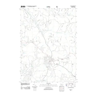
2011 Map of Kane
USGS Topo · Published 2011About this map
Kane occupies a prominent position on this McKean County landscape, situated where several headwater streams begin their descent from the high plateau. The town's grid of residential streets, from Oak St to Chestnut St, clusters near Clarion Summit, a key local geographic divide. The surrounding area is defined by its numerous watercourses, including South Branch Kinzua Creek and the East Branch Tionesta Creek, which carve deep valleys through the terrain. Small outlying settlements like East Kane, Greendale, and the curious locality of Jo Jo are interspersed with significant local institutions. Genealogists will find several burial grounds noted, such as Saint Callistus Cemetery and Mount Tabor Cemetery, while the Free Methodist Church Camp and Mountain Grange suggest the area's long-standing community and social foundations. To the south, Crystal Mineral Springs hints at the region's natural resources and the historical value placed on local water sources.
Find a feature on this map
79 named features on this map. Tap any name to fly to it.
Don’t see what you’re looking for? This feature index may not catch every label — zoom into the map to look around manually.
Map Details
Editions of this 2011 Kane Map
This is the sole edition of this map. No revisions or reprints were ever made.
Other maps of this area

1924 · Bradford
USGS Topo · 1:62,500

1926 · Bradford
USGS Topo · 1:62,500

1934 · Kane
USGS Topo · 1:48,000

1935 · Mt. Jewett
USGS Topo · 1:48,000

1936 · Kinzua
USGS Topo · 1:48,000

1939 · Kane
USGS Topo · 1:62,500

1940 · Mt. Jewett
USGS Topo · 1:62,500

1941 · Kinzua
USGS Topo · 1:62,500

1941 · Bradford
USGS Topo · 1:62,500

1944 · Bradford
USGS Topo · 1:62,500
Featured Places
- Kane, PA
- Sergeant, Wetmore Township
- Jo Jo, Wetmore Township
- East Kane, Wetmore Township
- Greendale, Wetmore Township