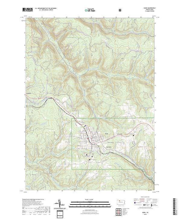
2023 Map of Kane
USGS Topo · Published 2023About this map
The Allegheny National Forest dominates the northern reaches of this territory, where a dense network of timber and access roads like FR 150 and Coal Mine Rd weave through the creek-cut drainages of the South Branch Kinzua Creek. The settlement pattern centers on Kane, a high-elevation borough surrounded by smaller communities including East Kane, Greendale, and Clarion Summit. The local topography is defined by the high ground of Rocky Ridge and numerous small waterways like Twomile Run and Threemile Run that carve through the wooded landscape.
Find a feature on this map
74 named features on this map. Tap any name to fly to it.
Don’t see what you’re looking for? This feature index may not catch every label — zoom into the map to look around manually.
Map Details
Editions of this 2023 Kane Map
This is the sole edition of this map. No revisions or reprints were ever made.
Other maps of this area

1924 · Bradford
USGS Topo · 1:62,500

1926 · Bradford
USGS Topo · 1:62,500

1934 · Kane
USGS Topo · 1:48,000

1935 · Mt. Jewett
USGS Topo · 1:48,000

1936 · Kinzua
USGS Topo · 1:48,000

1939 · Kane
USGS Topo · 1:62,500

1940 · Mt. Jewett
USGS Topo · 1:62,500

1941 · Kinzua
USGS Topo · 1:62,500

1941 · Bradford
USGS Topo · 1:62,500

1944 · Bradford
USGS Topo · 1:62,500