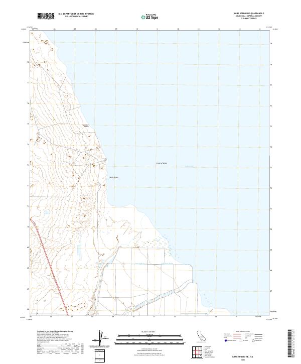
2021 Map of Kane Spring NE
USGS Topo · Published 2021About this map
Sea View Beach and Sandy Beach sit along the western edge of the Salton Sea, marking the intersection of desert shoreline and the engineered agricultural landscape of the Imperial Valley. This modern survey illustrates the persistent struggle for water management in one of the lowest elevations in North America, where the natural drainage of San Felipe Cr and the San Felipe Wash meets human-made irrigation infrastructure. Features such as the Trifolium Drain and Lateral Nine reflect the intensive plumbing required to sustain cultivation in this arid basin. The map captures a specific moment in the Salton Sea's receding shoreline, documenting the spatial relationship between small recreational outposts and the vast, saline water body that dominates the local geography.
Find a feature on this map
15 named features on this map. Tap any name to fly to it.
Don’t see what you’re looking for? This feature index may not catch every label — zoom into the map to look around manually.
Map Details
Editions of this 2021 Kane Spring NE Map
This is the sole edition of this map. No revisions or reprints were ever made.
Other maps of this area

1940 · Kane Spring
USGS Topo · 1:62,500

1940 · Frink
USGS Topo · 1:62,500

1940 · Durmid
USGS Topo · 1:62,500

1944 · Durmid
USGS Topo · 1:62,500

1944 · Kane Spring
USGS Topo · 1:62,500

1944 · Calipatria
USGS Topo · 1:62,500

1944 · Frink
USGS Topo · 1:62,500

1954 · Salton Sea
USGS Topo · 1:250,000

1955 · Salton Sea
USGS Topo · 1:250,000
1956 · Durmid SE
USGS Topo · 1:24,000