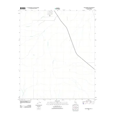
2012 Map of Kane Spring NW
USGS Topo · Published 2012About this map
The arid landscape of Imperial County is defined here by a network of seasonal drainage patterns carving through the desert floor. Major ephemeral channels including Surprise Wash, Tule Wash, and Campbell Wash dominate the topography, flowing generally toward the northeast. Near the northern edge of the sheet, the infrastructure of the Salton City area begins to take shape, centered around the Salton Sea Airport. The map documents a specifically planned layout of streets such as Skyway Dr, Air Park Dr, and Desert Air Ct, reflecting the residential and aviation-focused development of this desert community. A rare permanent water source, McCain Spring, is located in the western portion of the quadrangle, while Tarantula Wash cuts across the southwestern corner, illustrating the complex hydrography of the Colorado Desert region.
Find a feature on this map
9 named features on this map. Tap any name to fly to it.
Don’t see what you’re looking for? This feature index may not catch every label — zoom into the map to look around manually.
Map Details
Editions of this 2012 Kane Spring NW Map
This is the sole edition of this map. No revisions or reprints were ever made.
Other maps of this area

1904 · Indio
USGS Topo · 1:125,000

1931 · Vallecito
USGS Topo · 1:125,000

1940 · Kane Spring
USGS Topo · 1:62,500

1940 · Durmid
USGS Topo · 1:62,500

1942 · Barrel Spring
USGS Topo · 1:62,500

1942 · Agua Dulce
USGS Topo · 1:62,500

1943 · Vallecito
USGS Topo · 1:125,000

1944 · Agua Dulce
USGS Topo · 1:62,500

1944 · Durmid
USGS Topo · 1:62,500

1944 · Kane Spring
USGS Topo · 1:62,500