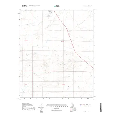
2018 Map of Kane Spring NW
USGS Topo · Published 2018About this map
Imperial Valley topography defines this arid landscape, where desert drainage systems converge near the western edge of the Salton Sea. The Salton Sea Airport serves as a modern focal point, with a small grid of residential streets including Skyway Dr and Air Park Dr hinting at the specialized development of the surrounding desert community. This area is heavily influenced by hydrological features, most notably McCain Spring, which provides a rare water source amidst the expansive network of dry washes. Seasonal runoff is channeled through Surprise Wash, Tule Wash, and Campbell Wash, which carve distinct paths through the alluvial terrain toward the valley floor. The map also records the western reach of Tarantula Wash, illustrating the complex drainage patterns essential for understanding the local environment in the late 2010s.
Find a feature on this map
15 named features on this map. Tap any name to fly to it.
Don’t see what you’re looking for? This feature index may not catch every label — zoom into the map to look around manually.
Map Details
Editions of this 2018 Kane Spring NW Map
This is the sole edition of this map. No revisions or reprints were ever made.
Other maps of this area

1904 · Indio
USGS Topo · 1:125,000

1931 · Vallecito
USGS Topo · 1:125,000

1940 · Kane Spring
USGS Topo · 1:62,500

1940 · Durmid
USGS Topo · 1:62,500

1942 · Barrel Spring
USGS Topo · 1:62,500

1942 · Agua Dulce
USGS Topo · 1:62,500

1943 · Vallecito
USGS Topo · 1:125,000

1944 · Agua Dulce
USGS Topo · 1:62,500

1944 · Durmid
USGS Topo · 1:62,500

1944 · Kane Spring
USGS Topo · 1:62,500