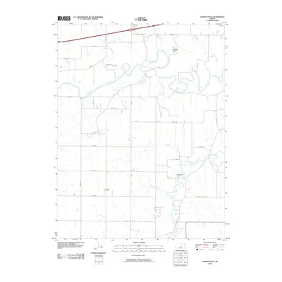
2009 Map of Kansas Falls
USGS Topo · Published 2009About this map
Kansas Falls and the surrounding Geary County landscape are defined by the meandering course of the Smoky Hill River as it flows eastward. This 2009 map documents a predominantly agricultural region where the river’s path creates distinctive landforms like Goat Island. To the south, Lyon Creek and its tributary Schuler Branch drain the prairie, where a grid of rural roads connects scattered homesteads and points of local heritage. Genealogists and local historians will find the Rinehart Cemetery situated along the section lines, while the proximity of Camp Aubrey Henning near the creek suggests a modern recreational or community use of the riparian corridor. The presence of Kickapoo School Rd preserves the name of former local educational landmarks within this updated digital-era survey.
Find a feature on this map
33 named features on this map. Tap any name to fly to it.
Don’t see what you’re looking for? This feature index may not catch every label — zoom into the map to look around manually.
Map Details
Editions of this 2009 Kansas Falls Map
This is the sole edition of this map. No revisions or reprints were ever made.
Other maps of this area

1886 · Junction City
USGS Topo · 1:125,000

1889 · Junction City
USGS Topo · 1:125,000

1889 · Abilene
USGS Topo · 1:125,000

1889 · Parkerville
USGS Topo · 1:125,000

1891 · Clay Center
USGS Topo · 1:125,000

1894 · Junction City
USGS Topo · 1:125,000

1894 · Abilene
USGS Topo · 1:125,000

1894 · Parkerville
USGS Topo · 1:125,000

1947 · Fort Riley
USGS Topo · 1:62,500

1950 · Junction City
USGS Topo · 1:24,000