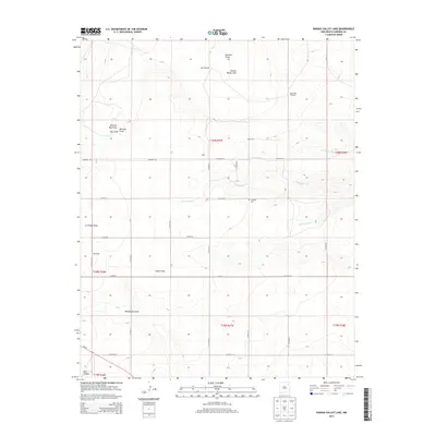
2013 Map of Kansas Valley Lake
USGS Topo · Published 2013About this map
Kansas Valley Lake and the surrounding rangelands of Harding County define this high plains landscape as it appeared in the early 21st century. The terrain is deeply inscribed with various drainage features, including the Matilda Roy Draw, Ivey Draw, and Reunion Draw, which funnel seasonal waters toward larger seasonal creek beds. These arroyos and canyons, such as Ross Canyon in the southwest, contrast with the systematic grid of county roads that carve the territory into sections. The rural character of the region is punctuated by water-management features like Lake Windmill and the evocative Starvation Windmill. Evidence of early settlement and ranching families persists through place names like Hicks, Bouleware, and Alexander, alongside the Johnson Cem, which provides a vital point of reference for genealogists tracking the history of this isolated New Mexico quadrant.
Find a feature on this map
38 named features on this map. Tap any name to fly to it.
Don’t see what you’re looking for? This feature index may not catch every label — zoom into the map to look around manually.
Map Details
Editions of this 2013 Kansas Valley Lake Map
This is the sole edition of this map. No revisions or reprints were ever made.
Other maps of this area

1954 · Santa Fe
USGS Topo · 1:250,000

1954 · Raton
USGS Topo · 1:250,000

1954 · Tucumcari
USGS Topo · 1:250,000

1954 · Dalhart
USGS Topo · 1:250,000

1958 · Raton
USGS Topo · 1:250,000

1958 · Santa Fe
USGS Topo · 1:250,000

1958 · Tucumcari
USGS Topo · 1:250,000

1958 · Dalhart
USGS Topo · 1:250,000

1962 · Dalhart
USGS Topo · 1:250,000

1973 · Mosquero
USGS Topo · 1:24,000