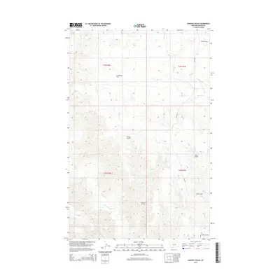
2014 Map of Karsten Coulee
USGS Topo · Published 2014About this map
Karsten Coulee defines the drainage patterns of this Phillips County landscape, where the high plains of northern Montana are etched by seasonal watercourses and wide depressions. The terrain is characterized by expansive features like Cruikshank Flat and the repeating draws of Dam Coulee and North Coulee. Local hydrology is managed through a series of drainages including Dry Fork Cr, Fourchette Cr, and Beauchamp Cr, which carve through the land before reaching the Missouri River breaks to the south. Human presence is sparse, marked primarily by the path of Midale Rd and the systematic divisions of the Public Land Survey System. This 2014 survey captures the area's transition between grazing lands and the complex topography of the coulee systems, providing a clear record of the physical geography used by local ranchers and land managers.
Find a feature on this map
12 named features on this map. Tap any name to fly to it.
Don’t see what you’re looking for? This feature index may not catch every label — zoom into the map to look around manually.
Map Details
Editions of this 2014 Karsten Coulee Map
This is the sole edition of this map. No revisions or reprints were ever made.
Other maps of this area

1954 · Jordan
USGS Topo · 1:250,000

1954 · Lewistown
USGS Topo · 1:250,000

1956 · Jordan
USGS Topo · 1:250,000

1958 · Jordan
USGS Topo · 1:250,000

1959 · Lewistown
USGS Topo · 1:250,000

1964 · Jordan
USGS Topo · 1:250,000

1965 · Karsten Coulee
USGS Topo · 1:24,000

1965 · Dry Coulee
USGS Topo · 1:24,000

1965 · Chain Buttes
USGS Topo · 1:24,000

1965 · Locke Ranch
USGS Topo · 1:24,000