
1965 Map of Locke Ranch
USGS Topo · Published 1969About this map
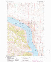
Fort Peck Reservoir dominates the center of this 1960s landscape, marking the flooded channel of the Missouri River as it winds through central Montana. The map illustrates a transitional period for the Charles M. Russell National Wildlife Range, showing the intersection of managed federal lands and private holdings like Locke Ranch. The terrain is defined by dramatic elevation changes where the plateau of Hawley Flat drops into deeply eroded drainages such as Coburn Coulee and Dam Coulee. Isolated infrastructure, including Legg Well and remote Landing Strips, points to the region's reliance on aviation and livestock ranching. The boundary between Phillips Co and Petroleum Co bisects the reservoir, while named points like West Bend and Jim Bend provide navigation markers along the vast shoreline.
Find a feature on this map
21 named features on this map. Tap any name to fly to it.
Don’t see what you’re looking for? This feature index may not catch every label — zoom into the map to look around manually.
Map Details
Editions of this 1965 Locke Ranch Map
2 editions found
Other maps of this area

1954 · Jordan
USGS Topo · 1:250,000

1954 · Lewistown
USGS Topo · 1:250,000

1956 · Jordan
USGS Topo · 1:250,000

1958 · Jordan
USGS Topo · 1:250,000

1959 · Lewistown
USGS Topo · 1:250,000

1964 · Jordan
USGS Topo · 1:250,000

1965 · Karsten Coulee
USGS Topo · 1:24,000

1965 · Germaine Coulee East
USGS Topo · 1:24,000

1965 · Germaine Coulee West
USGS Topo · 1:24,000

1965 · Chain Buttes
USGS Topo · 1:24,000