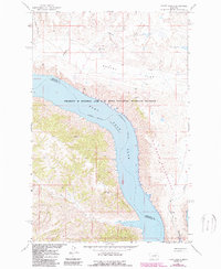
1965 Map of Locke Ranch
USGS Topo · Published 1988About this map
Locke Ranch sits within a landscape defined by the expansive waters of Fort Peck Lake and the winding course of the Missouri River. This mid-1960s survey, updated in the late 1980s, details a transition from traditional cattle ranching to a landscape of federal conservation and resource extraction. The northern portion is dominated by the broad plateau of Hawley Flat, while the southern reaches are marked by the rugged drainage of Soda Creek and Jim Wells Creek. Evidence of mid-century industrial activity appears via the Phillips Co Petroleum Co and isolated Landing Strips. Large portions of the quadrangle are dedicated to the Charles M Russell and UL Bend National Wildlife Refuges and the UL Bend Wilderness, preserving the distinct character of the UL Bend as it reaches into the reservoir.
Find a feature on this map
21 named features on this map. Tap any name to fly to it.
Don’t see what you’re looking for? This feature index may not catch every label — zoom into the map to look around manually.
Map Details
Editions of this 1965 Locke Ranch Map
2 editions found

Other maps of this area

1954 · Jordan
USGS Topo · 1:250,000

1954 · Lewistown
USGS Topo · 1:250,000

1956 · Jordan
USGS Topo · 1:250,000

1958 · Jordan
USGS Topo · 1:250,000

1959 · Lewistown
USGS Topo · 1:250,000

1964 · Jordan
USGS Topo · 1:250,000

1965 · Karsten Coulee
USGS Topo · 1:24,000

1965 · Germaine Coulee East
USGS Topo · 1:24,000

1965 · Germaine Coulee West
USGS Topo · 1:24,000

1965 · Chain Buttes
USGS Topo · 1:24,000