
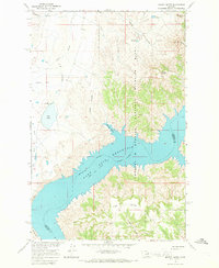
1965 Map of Germaine Coulee East
USGS Topo · Published 1968About this map
The Charles M. Russell National Wildlife Range dominates this mid-1960s landscape, protecting the breaks and coulees along the southern edge of the Fort Peck Reservoir. This portion of the Missouri River basin shows a topography defined by complex drainage systems, where seasonal watercourses like Sandburn Coulee and Germaine Coulee cut deep into the plateau. The map captures the reservoir at its normal pool elevation of 2,246 feet, with dashed light-blue patterns indicating areas subject to controlled inundation.
Find a feature on this map
16 named features on this map. Tap any name to fly to it.
Don’t see what you’re looking for? This feature index may not catch every label — zoom into the map to look around manually.
Map Details
Editions of this 1965 Germaine Coulee East Map
This is the sole edition of this map. No revisions or reprints were ever made.
Other maps of this area

1954 · Jordan
USGS Topo · 1:250,000

1956 · Jordan
USGS Topo · 1:250,000

1958 · Jordan
USGS Topo · 1:250,000

1964 · Jordan
USGS Topo · 1:250,000

1965 · Germaine Coulee West
USGS Topo · 1:24,000

1965 · Lost Creek
USGS Topo · 1:24,000

1965 · Locke Ranch
USGS Topo · 1:24,000

1965 · Cap Rock Butte
USGS Topo · 1:24,000
1965 · Mickey Butte
USGS Topo · 1:24,000

1967 · Nelson Coulee
USGS Topo · 1:24,000