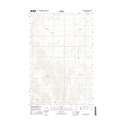
2017 Map of Karsten Coulee
USGS Topo · Published 2017About this map
Cruikshank Flat sits at the heart of this high-plains landscape, where the seasonal hydrology of Phillips County is clearly defined. The terrain is marked by a series of significant drainages, including the headwaters of Dry Fork Cr and the winding course of Fourchette Cr to the east. The map illustrates a complex network of coulees that provide natural drainage across the varying elevations, most notably North Coulee, Dam Coulee, and the namesake Karsten Coulee at the southern edge of the survey. The movement of water through Beauchamp Cr and Camp Cr reveals the natural topography that shaped early cattle ranching and land use in this part of Montana. Human presence is represented primarily by Midale Rd, which traverses the eastern sections, and the established township and range boundaries that partitioned the territory into large grazing tracts.
Find a feature on this map
13 named features on this map. Tap any name to fly to it.
Don’t see what you’re looking for? This feature index may not catch every label — zoom into the map to look around manually.
Map Details
Editions of this 2017 Karsten Coulee Map
This is the sole edition of this map. No revisions or reprints were ever made.
Other maps of this area

1954 · Jordan
USGS Topo · 1:250,000

1954 · Lewistown
USGS Topo · 1:250,000

1956 · Jordan
USGS Topo · 1:250,000

1958 · Jordan
USGS Topo · 1:250,000

1959 · Lewistown
USGS Topo · 1:250,000

1964 · Jordan
USGS Topo · 1:250,000

1965 · Karsten Coulee
USGS Topo · 1:24,000

1965 · Dry Coulee
USGS Topo · 1:24,000

1965 · Chain Buttes
USGS Topo · 1:24,000

1965 · Locke Ranch
USGS Topo · 1:24,000