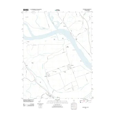
2012 Map of Kaskaskia
USGS Topo · Published 2012About this map
Kaskaskia Island sits at the heart of this landscape, where the shifting courses of the Mississippi River and Kaskaskia River define a complex border between Illinois and Missouri. The map illustrates the unusual geography of Kaskaskia, the former Illinois capital now isolated on the western side of the current river channel. Significant historical points are marked throughout the bottomlands, including Old Kaskaskia, Fort Gage, and the small settlement of Dozaville. To the south, Saint Mary serves as a gateway to this floodplain, which is crisscrossed by historic routes like La Grand Rue and Shawneetown Trl. Researchers can trace the legacy of river commerce through landmarks like Farmers Landing, Okaw Landing, and Delassus Landing Field, while the presence of the Kaskaskia Cem and Saint Marys Cem provides essential points of interest for genealogists investigating families from these storied river towns.
Find a feature on this map
68 named features on this map. Tap any name to fly to it.
Don’t see what you’re looking for? This feature index may not catch every label — zoom into the map to look around manually.
Map Details
Editions of this 2012 Kaskaskia Map
This is the sole edition of this map. No revisions or reprints were ever made.
Other maps of this area

1907 · Weingarten
USGS Topo · 1:62,500

1909 · Weingarten
USGS Topo · 1:62,500

1912 · Baldwin
USGS Topo · 1:62,500

1914 · Baldwin
USGS Topo · 1:62,500

1915 · Renault
USGS Topo · 1:62,500

1915 · Chester
USGS Topo · 1:62,500

1940 · Renault
USGS Topo · 1:62,500

1942 · Baldwin
USGS Topo · 1:62,500

1947 · Chester
USGS Topo · 1:62,500

1949 · Saint Louis
USGS Topo · 1:250,000