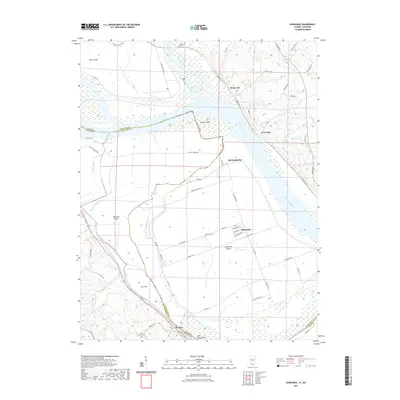
2021 Map of Kaskaskia
USGS Topo · Published 2021About this map
Kaskaskia Island dominates this stretch of the Mississippi River valley, where state and county lines shift through a complex network of sloughs and old riverbeds. The settlement of Kaskaskia and the nearby site of Old Kaskaskia sit at the center of this unique geography, bordered by the Kaskaskia River to the north. These communities are defined by a grid of local roads including La Grande Rue and N Kings Hwy, which connect the riverfront to the interior farmland. To the southwest, the town of St. Mary sits along Saint Marys Bend, where the terrain begins to rise away from the floodplains. Genealogists will find the Kaskaskia Cem and Saint Marys Cem clearly marked, while physical landmarks like Beaver Island and Idlewild Slough trace the persistent impact of the river's historical meanders on the Illinois and Missouri borderlands.
Find a feature on this map
69 named features on this map. Tap any name to fly to it.
Don’t see what you’re looking for? This feature index may not catch every label — zoom into the map to look around manually.
Map Details
Editions of this 2021 Kaskaskia Map
This is the sole edition of this map. No revisions or reprints were ever made.
Other maps of this area

1907 · Weingarten
USGS Topo · 1:62,500

1909 · Weingarten
USGS Topo · 1:62,500

1912 · Baldwin
USGS Topo · 1:62,500

1914 · Baldwin
USGS Topo · 1:62,500

1915 · Renault
USGS Topo · 1:62,500

1915 · Chester
USGS Topo · 1:62,500

1940 · Renault
USGS Topo · 1:62,500

1942 · Baldwin
USGS Topo · 1:62,500

1947 · Chester
USGS Topo · 1:62,500

1949 · Saint Louis
USGS Topo · 1:250,000