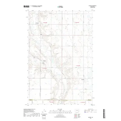
2018 Map of Kathryn
USGS Topo · Published 2018About this map
Kathryn sits at the base of the winding Sheyenne River valley, where the steep bluffs of the southeastern North Dakota plains give way to a concentrated network of local roads and trails. This 2018 survey reveals the community's layout near Spring Cr, including the intersection of 1st Ave and 2nd Ave. The geography is defined by the sharp relief of the river valley, which contrasts with the high, prairie farmland to the east and west. Genealogists and local historians can locate long-established landmarks like the Canaan Moravian Church Cemetery to the north and Saint Pauls Cem situated on the heights overlooking the town. The N Country National Scenic Trail winds through this dramatic landscape, tracing the river's edge and connecting the primary settlement to the outlying areas of Daily and Eastedge.
Find a feature on this map
41 named features on this map. Tap any name to fly to it.
Don’t see what you’re looking for? This feature index may not catch every label — zoom into the map to look around manually.
Map Details
Editions of this 2018 Kathryn Map
This is the sole edition of this map. No revisions or reprints were ever made.
Other maps of this area

1897 · Tower
USGS Topo · 1:125,000

1897 · Eckelson
USGS Topo · 1:125,000

1953 · Jamestown
USGS Topo · 1:250,000

1953 · Fargo
USGS Topo · 1:250,000

1956 · Fargo
USGS Topo · 1:250,000

1956 · Jamestown
USGS Topo · 1:250,000

1967 · Ft. Ransom
USGS Topo · 1:24,000

1967 · Fingal
USGS Topo · 1:24,000

1967 · Fingal SW
USGS Topo · 1:24,000
1967 · Nome SE
USGS Topo · 1:24,000