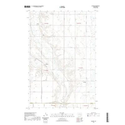
2020 Map of Kathryn
USGS Topo · Published 2020About this map
The Sheyenne River winds through a landscape defined by deep-cut valleys and upland plateaus on this 2020 topographic study. The village of Kathryn serves as the primary hub, situated where the valley floor widens, while smaller locales like Daily and Eastedge occupy the surrounding rural townships. This map provides a clear picture of the region's cultural geography, marking local landmarks such as Saint Pauls Cem and Sheyenne Valley Cem which offer vital clues for genealogical research. Modern recreation is highlighted by the passage of the N Country National Scenic Trail, which traces the contours of the valley bluffs. The infrastructure is characterized by a grid of rural roads like Kathryn Valley Rd and 54th St SE, which defines the border between Barnes Co and Ransom Co.
Find a feature on this map
30 named features on this map. Tap any name to fly to it.
Don’t see what you’re looking for? This feature index may not catch every label — zoom into the map to look around manually.
Map Details
Editions of this 2020 Kathryn Map
This is the sole edition of this map. No revisions or reprints were ever made.
Other maps of this area

1897 · Tower
USGS Topo · 1:125,000

1897 · Eckelson
USGS Topo · 1:125,000

1953 · Jamestown
USGS Topo · 1:250,000

1953 · Fargo
USGS Topo · 1:250,000

1956 · Fargo
USGS Topo · 1:250,000

1956 · Jamestown
USGS Topo · 1:250,000

1967 · Ft. Ransom
USGS Topo · 1:24,000

1967 · Fingal
USGS Topo · 1:24,000

1967 · Fingal SW
USGS Topo · 1:24,000
1967 · Nome SE
USGS Topo · 1:24,000