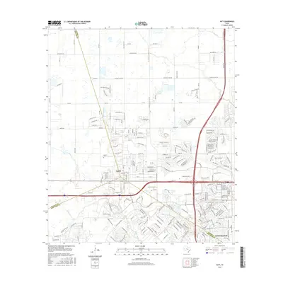
2016 Map of Katy
USGS Topo · Published 2016About this map
Katy serves as the focal point of this 2016 survey, situated at the convergence of Harris, Waller, and Fort Bend counties. This era reveals a landscape in rapid transition from its agricultural roots toward dense suburban development, particularly evident in the expansive master-planned community of Cinco Ranch to the southeast. The natural drainage of the Gulf Coastal Plain is marked by the headwaters of Buffalo Bayou and the meandering course of the Willow Fork, which are increasingly hemmed in by residential street networks and the massive Katy Fwy corridor.
Find a feature on this map
195 named features on this map. Tap any name to fly to it.
Don’t see what you’re looking for? This feature index may not catch every label — zoom into the map to look around manually.
Map Details
Editions of this 2016 Katy Map
This is the sole edition of this map. No revisions or reprints were ever made.
Other maps of this area

1915 · Cypress
USGS Topo · 1:24,000

1915 · Katy
USGS Topo · 1:24,000

1915 · Addicks
USGS Topo · 1:24,000

1915 · Clodine
USGS Topo · 1:24,000

1916 · Swanson
USGS Topo · 1:24,000

1918 · Cypress
USGS Topo · 1:31,680

1918 · Addicks
USGS Topo · 1:31,680

1919 · Clodine
USGS Topo · 1:31,680

1919 · Swanson
USGS Topo · 1:31,680

1950 · Houston
USGS Topo · 1:250,000