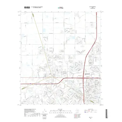
2019 Map of Katy
USGS Topo · Published 2019About this map
The growing city of Katy serves as the focal point of this 2019 survey, illustrating the rapid expansion of the Houston metropolitan area. The landscape is defined by its drainage network, including the headwaters of Buffalo Bayou and Willow Fork, which are surrounded by increasingly dense residential developments like Mayde Creek Ests and Katy Lake Estates Dr. This era of development is marked by a complex grid of thoroughfares such as Katy Hockley Rd and Beckendorff Rd that weave through former agricultural lands.
Find a feature on this map
253 named features on this map. Tap any name to fly to it.
Don’t see what you’re looking for? This feature index may not catch every label — zoom into the map to look around manually.
Map Details
Editions of this 2019 Katy Map
This is the sole edition of this map. No revisions or reprints were ever made.
Other maps of this area

1915 · Cypress
USGS Topo · 1:24,000

1915 · Katy
USGS Topo · 1:24,000

1915 · Addicks
USGS Topo · 1:24,000

1915 · Clodine
USGS Topo · 1:24,000

1916 · Swanson
USGS Topo · 1:24,000

1918 · Cypress
USGS Topo · 1:31,680

1918 · Addicks
USGS Topo · 1:31,680

1919 · Clodine
USGS Topo · 1:31,680

1919 · Swanson
USGS Topo · 1:31,680

1950 · Houston
USGS Topo · 1:250,000