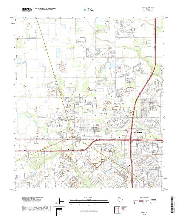
2022 Map of Katy
USGS Topo · Published 2022About this map
Katy sits at the intersection of three counties, serving as a focal point for this rapidly evolving landscape west of Houston. This 2022 survey shows a dense network of suburban development intertwined with critical drainage systems like Buffalo Bayou, Willow Fork, and Cane Island Br. The map details the modern infrastructure of the Katy Fwy and 99 corridor, which now surrounds established local landmarks. Genealogists will find the locations of the Katy Magnolia Cem and Katy Community Cem preserved amidst the expansion, while the presence of the University of Houston Victoria at Katy reflects the area's continued growth as an educational and residential hub. The intricate street patterns, including Beckendorff Rd and Kingsland Blvd, provide a high-resolution view of the contemporary community's footprint.
Find a feature on this map
60 named features on this map. Tap any name to fly to it.
Don’t see what you’re looking for? This feature index may not catch every label — zoom into the map to look around manually.
Map Details
Editions of this 2022 Katy Map
This is the sole edition of this map. No revisions or reprints were ever made.
Other maps of this area

1915 · Cypress
USGS Topo · 1:24,000

1915 · Katy
USGS Topo · 1:24,000

1915 · Addicks
USGS Topo · 1:24,000

1915 · Clodine
USGS Topo · 1:24,000

1916 · Swanson
USGS Topo · 1:24,000

1918 · Cypress
USGS Topo · 1:31,680

1918 · Addicks
USGS Topo · 1:31,680

1919 · Clodine
USGS Topo · 1:31,680

1919 · Swanson
USGS Topo · 1:31,680

1950 · Houston
USGS Topo · 1:250,000