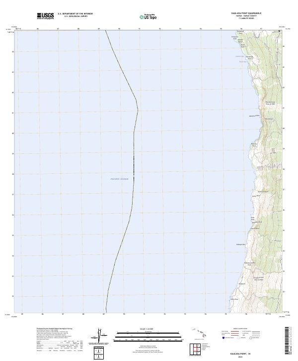
2024 Map of Kauluoa Point
USGS Topo · Published 2024About this map
The Honokua Lava Flow of 1950 and Ka'apuna Lava Flow of 1950 dominate this coastal section of the Island of Hawai'i, illustrating the geological forces that have shaped the Kona coast. The map detail highlights the intersection of modern infrastructure and volcanic history, where the S Kona Belt Rd and Old Govt Rd traverse a landscape marked by steep cliffs like Pali Kaholo and rocky shorelines. Small coastal landmarks, including the Kalahiki Cem and the settlement at Ka'apuna, provide evidence of human presence amidst the basalt flows and sea-facing points like Kauluoa Point and Hoku Point. This survey captures a specific stretch of the Pacific coast where geographic features like Kalahiki Beach and Lapawai Bay are defined by the cooling of mid-century volcanic activity.
Find a feature on this map
29 named features on this map. Tap any name to fly to it.
Don’t see what you’re looking for? This feature index may not catch every label — zoom into the map to look around manually.
Map Details
Editions of this 2024 Kauluoa Point Map
This is the sole edition of this map. No revisions or reprints were ever made.
Other maps of this area

1928 · Hoopuloa
USGS Topo · 1:62,500

1954 · Hawaii South
USGS Topo · 1:250,000

1959 · Hawaii South
USGS Topo · 1:250,000

1959 · Honaunau
USGS Topo · 1:24,000
1960 · Kaunene
USGS Topo · 1:24,000

1961 · Hawaii South
USGS Topo · 1:250,000

1962 · Hawaii South
USGS Topo · 1:250,000

1962 · Milolii
USGS Topo · 1:24,000

1962 · Papa
USGS Topo · 1:24,000
1962 · Kauluoa Point
USGS Topo · 1:24,000