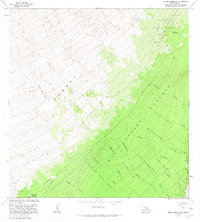
1981 Map of Keaiwa Reservoir
USGS Topo · Published 1983About this map
The Lava Flow of 1926 and Lava Flow of 1950 define the high western slopes of this Hawaii Island landscape, illustrating the active volcanic history of the Kahuku region. These frozen rivers of stone contrast with the dense vegetation of the Kapapala Forest Reserve and Kaa Forest Reserve to the east. At lower elevations, the map records essential water management infrastructure like the Keaiwa Reservoir, the Noguchi Tunnel, and the Maunaanu Waterhole, which supported the land's transition from volcanic wilderness to managed resource areas. Numerous steep drainages, such as Moaula Gulch and Hionamoa Gulch, carve through the terrain toward the coast, while high points like Puu Kinikini and Kilohana provide orientation across the steep gradient.
Find a feature on this map
38 named features on this map. Tap any name to fly to it.
Don’t see what you’re looking for? This feature index may not catch every label — zoom into the map to look around manually.
Map Details
Editions of this 1981 Keaiwa Reservoir Map
2 editions found
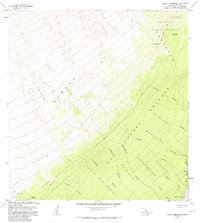
Other maps of this area

1921 · Kilauea
USGS Topo · 1:62,500

1923 · Pahala
USGS Topo · 1:62,500

1924 · Kilauea
USGS Topo · 1:62,500

1924 · Honuapo
USGS Topo · 1:62,500

1928 · Mauna Loa
USGS Topo · 1:62,500

1954 · Hawaii South
USGS Topo · 1:250,000

1959 · Hawaii South
USGS Topo · 1:250,000

1961 · Hawaii South
USGS Topo · 1:250,000

1962 · Hawaii South
USGS Topo · 1:250,000
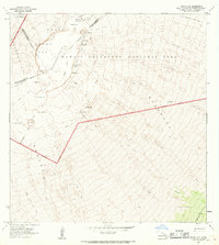
1966 · Mauna Loa
USGS Topo · 1:24,000