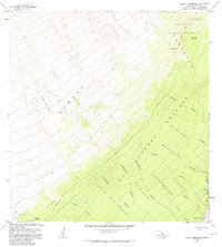
1981 Map of Keaiwa Reservoir
USGS Topo · Published 1981About this map
The volcanic slopes of Mauna Loa dominate this 1981 survey of the Kau District, where successive eruption events have shaped the modern landscape. The map captures the distinct boundaries of several major events, including the Lava Flow of 1926, the Lava Flow of 1949, and the Lava Flow of 1950. These flows cut across the Kahuku and Kapapala lands, occasionally leaving behind islands of older vegetation like Kipuka Aiaka Alala.
Find a feature on this map
37 named features on this map. Tap any name to fly to it.
Don’t see what you’re looking for? This feature index may not catch every label — zoom into the map to look around manually.
Map Details
Editions of this 1981 Keaiwa Reservoir Map
2 editions found
Other maps of this area

1921 · Kilauea
USGS Topo · 1:62,500

1923 · Pahala
USGS Topo · 1:62,500

1924 · Kilauea
USGS Topo · 1:62,500

1924 · Honuapo
USGS Topo · 1:62,500

1928 · Mauna Loa
USGS Topo · 1:62,500

1954 · Hawaii South
USGS Topo · 1:250,000

1959 · Hawaii South
USGS Topo · 1:250,000

1961 · Hawaii South
USGS Topo · 1:250,000

1962 · Hawaii South
USGS Topo · 1:250,000
1966 · Mauna Loa
USGS Topo · 1:24,000