2021 Map of Kearney
USGS Topo · Published 2021About this map
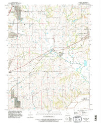
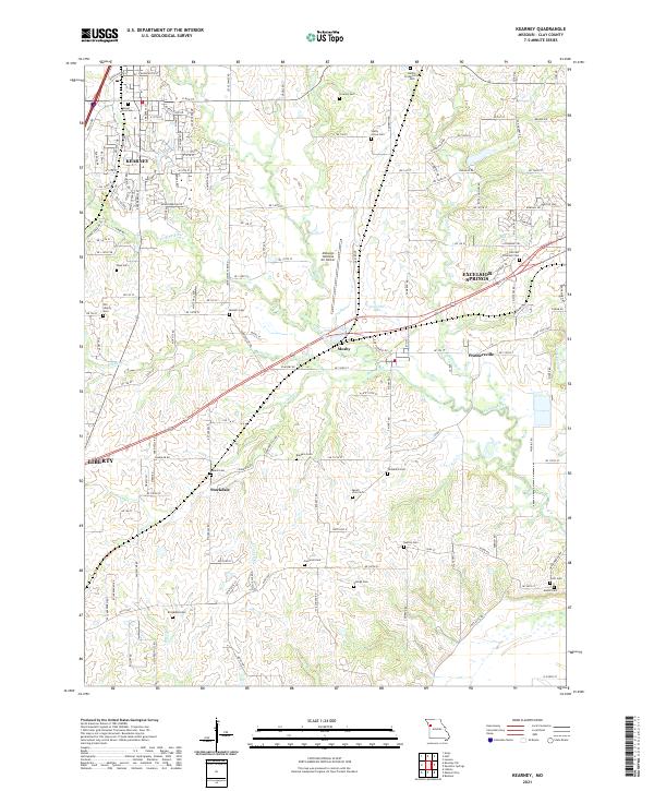
The western edges of Excelsior Springs and the growing municipality of Kearney anchor this 2021 landscape in Clay County. The terrain is defined by the dendritic drainage of the Fishing River and its tributaries, including Williams Cr and Holmes Cr. This modern survey reveals a dense concentration of historical burial sites that serve as a record of early settlement patterns, such as Mount Olive Cem, Crowley Cem, and Munkirs Cem. Aviation infrastructure is prominent at the Midwest National Air Center, while the presence of Lone Star Lake suggests the local management of water resources. Smaller rural communities like Mosby, Prathersville, and Stockdale remain distinct amidst a network of county roads, showing the continued importance of these named places within the regional geography.
Find a feature on this map
154 named features on this map. Tap any name to fly to it.
Don’t see what you’re looking for? This feature index may not catch every label — zoom into the map to look around manually.
Map Details
Editions of this 2021 Kearney Map
This is the sole edition of this map. No revisions or reprints were ever made.
Historical Maps of Mosby Through Time
6 maps found