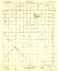
1947 Map of Kearney Park
USGS Topo · Published 1947About this map
The irrigated plains of the San Joaquin Valley west of Fresno appear in their mid-century grid, centered on the historic Kearney Park estate. The landscape is defined by a dense network of water management features, including the Little Houghton Canal and Houghton Canal, which supported the region's agricultural transition. Small rural nodes like Rolinda and the rail-stop at Rolinda Sta trace the path of the Southern Pacific railroad line through the northern territory.
Find a feature on this map
35 named features on this map. Tap any name to fly to it.
Don’t see what you’re looking for? This feature index may not catch every label — zoom into the map to look around manually.
Map Details
Editions of this 1947 Kearney Park Map
2 editions found
Other maps of this area

1921 · Bullard
USGS Topo · 1:31,680

1923 · Kearney Park
USGS Topo · 1:31,680

1923 · Herndon
USGS Topo · 1:31,680

1923 · Fresno
USGS Topo · 1:31,680

1923 · Biola
USGS Topo · 1:31,680

1923 · Bullard
USGS Topo · 1:31,680

1925 · Helm
USGS Topo · 1:31,680

1925 · Raisin
USGS Topo · 1:31,680

1925 · Caruthers
USGS Topo · 1:31,680
1946 · Fresno South
USGS Topo · 1:24,000