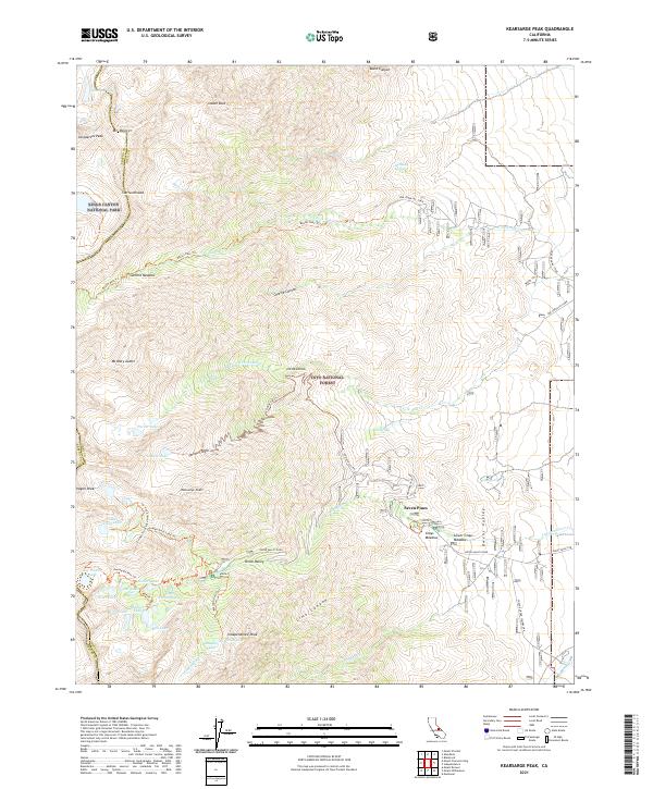
2021 Map of Kearsarge Peak
USGS Topo · Published 2021About this map
Kearsarge Peak dominates the central landscape of this eastern High Sierra survey, where the steep escarpment of the Inyo National Forest meets the rugged high-country boundary of Kings Canyon National Park. The map documents a dense network of alpine trails and water sources essential for backcountry travel, including the Kearsarge Pass Trl and Baxter Pass Trl. These routes connect a series of high-altitude basins containing Parker Lakes, Golden Trout Lake, and Matlock Lake. In the lower elevations to the east, the geography transitions toward the Owens Valley via Onion Valley Rd. Small settlements and seasonal destinations such as Onion Valley, Little Onion, and Seven Pines serve as focal points for local history and recreation, while landmarks like Mt Baxter and Independence Peak define the horizon.
Find a feature on this map
61 named features on this map. Tap any name to fly to it.
Don’t see what you’re looking for? This feature index may not catch every label — zoom into the map to look around manually.
Map Details
Editions of this 2021 Kearsarge Peak Map
This is the sole edition of this map. No revisions or reprints were ever made.
Other maps of this area

1907 · Mt. Whitney
USGS Topo · 1:125,000

1919 · Mt. Whitney
USGS Topo · 1:125,000

1937 · Mt. Whitney
USGS Topo · 1:125,000

1948 · Fresno
USGS Topo · 1:250,000

1951 · Independence
USGS Topo · 1:62,500

1953 · Mt. Pinchot
USGS Topo · 1:62,500

1955 · Fresno
USGS Topo · 1:250,000

1956 · Fresno
USGS Topo · 1:250,000

1956 · Mount Whitney
USGS Topo · 1:62,500

1958 · Fresno
USGS Topo · 1:250,000