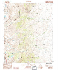
1992 Map of Kearsarge Peak
USGS Topo · Published 1994About this map
The John Muir Wilderness and the Bighorn Sheep Zoological Area dominate this high-elevation landscape along the Sierra Crest. In the early 1990s, this area of the Inyo National Forest served as a critical habitat for protected species while providing remote access for backcountry exploration. The map highlights the steep drainages of Thibaut Creek and the North and South Forks of Oak Creek, which descend sharply from peaks like Mount Baxter and Acrodectes Peak.
Find a feature on this map
49 named features on this map. Tap any name to fly to it.
Don’t see what you’re looking for? This feature index may not catch every label — zoom into the map to look around manually.
Map Details
Editions of this 1992 Kearsarge Peak Map
This is the sole edition of this map. No revisions or reprints were ever made.
Other maps of this area

1907 · Mt. Whitney
USGS Topo · 1:125,000

1919 · Mt. Whitney
USGS Topo · 1:125,000

1937 · Mt. Whitney
USGS Topo · 1:125,000

1948 · Fresno
USGS Topo · 1:250,000

1951 · Independence
USGS Topo · 1:62,500

1953 · Mt. Pinchot
USGS Topo · 1:62,500

1955 · Fresno
USGS Topo · 1:250,000

1956 · Fresno
USGS Topo · 1:250,000

1956 · Mount Whitney
USGS Topo · 1:62,500

1958 · Fresno
USGS Topo · 1:250,000