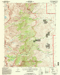
1994 Map of Kearsarge Peak
USGS Topo · Published 1997About this map
Independence Creek flows through the high country of the eastern Sierra, where the John Muir Wilderness meets the protected reaches of the Bighorn Sheep Zoological Area. This landscape is defined by its extreme alpine topography and the early 1990s management of public lands, including portions of Kings Canyon National Park and Inyo National Forest. The map documents a cluster of high-altitude lakes, such as Matlock Lake, Gilbert Lake, and Big Pothole Lake, which are characteristic of the glaciated terrain surrounding Kearsarge Peak.
Find a feature on this map
54 named features on this map. Tap any name to fly to it.
Don’t see what you’re looking for? This feature index may not catch every label — zoom into the map to look around manually.
Map Details
Editions of this 1994 Kearsarge Peak Map
This is the sole edition of this map. No revisions or reprints were ever made.
Other maps of this area

1907 · Mt. Whitney
USGS Topo · 1:125,000

1919 · Mt. Whitney
USGS Topo · 1:125,000

1937 · Mt. Whitney
USGS Topo · 1:125,000

1948 · Fresno
USGS Topo · 1:250,000

1951 · Independence
USGS Topo · 1:62,500

1953 · Mt. Pinchot
USGS Topo · 1:62,500

1955 · Fresno
USGS Topo · 1:250,000

1956 · Fresno
USGS Topo · 1:250,000

1956 · Mount Whitney
USGS Topo · 1:62,500

1958 · Fresno
USGS Topo · 1:250,000