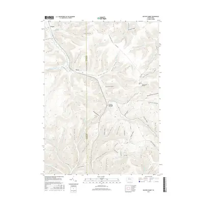
2016 Map of Keating Summit
USGS Topo · Published 2016About this map
Keating Summit sits at a high point in the northern Pennsylvania highlands, serving as a geographic divide where the headwaters of several drainages begin their descent. This 2016 survey shows the intricate network of hollows and ridges that define the border between McKean and Potter Counties. The landscape is heavily influenced by its timbering and transit history, evidenced by names like Planing Mill Hollow and the Civil Conservation Corps Road.
Find a feature on this map
67 named features on this map. Tap any name to fly to it.
Don’t see what you’re looking for? This feature index may not catch every label — zoom into the map to look around manually.
Map Details
Editions of this 2016 Keating Summit Map
This is the sole edition of this map. No revisions or reprints were ever made.
Other maps of this area

1933 · Smethport
USGS Topo · 1:62,500

1934 · Coudersport
USGS Topo · 1:48,000

1937 · Smethport
USGS Topo · 1:62,500

1938 · Coudersport
USGS Topo · 1:62,500

1948 · Crosby
USGS Topo · 1:62,500

1948 · Emporium
USGS Topo · 1:62,500

1948 · Keating Summit
USGS Topo · 1:24,000

1948 · Emporium
USGS Topo · 1:24,000
1948 · Wharton
USGS Topo · 1:24,000

1948 · Rich Valley
USGS Topo · 1:24,000
Featured Places
- Liberty Township, PA
- Roulette Township, PA
- Norwich Township, PA
- Keating Township, PA
- Keating Summit, Keating Township