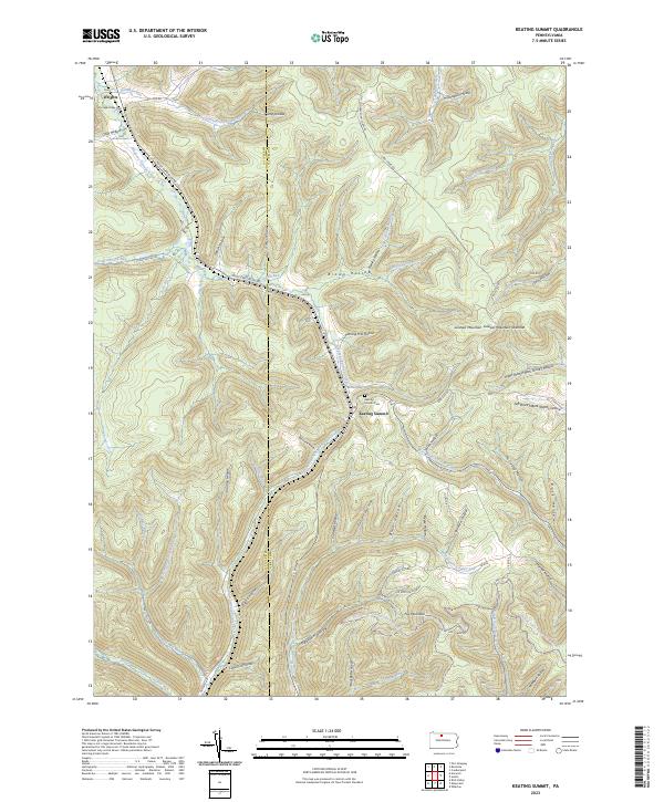
2023 Map of Keating Summit
USGS Topo · Published 2023About this map
Keating Summit and Wrights anchor the high ground along the McKean Co and Potter Co border, where the headwaters of several major creek systems diverge. The topography is defined by a dense network of hollows, such as Cody Hollow and Brown Hollow, which channel water toward Sinnemahoning Portage Creek and the Allegheny Portage Creek. This area has long served as a critical passage between watersheds, a role reflected in the local road names and the placement of the Keating Summit Cem and Portage Valley Cem.
Find a feature on this map
69 named features on this map. Tap any name to fly to it.
Don’t see what you’re looking for? This feature index may not catch every label — zoom into the map to look around manually.
Map Details
Editions of this 2023 Keating Summit Map
This is the sole edition of this map. No revisions or reprints were ever made.
Other maps of this area

1933 · Smethport
USGS Topo · 1:62,500

1934 · Coudersport
USGS Topo · 1:48,000

1937 · Smethport
USGS Topo · 1:62,500

1938 · Coudersport
USGS Topo · 1:62,500

1948 · Crosby
USGS Topo · 1:62,500

1948 · Emporium
USGS Topo · 1:62,500

1948 · Keating Summit
USGS Topo · 1:24,000

1948 · Emporium
USGS Topo · 1:24,000
1948 · Wharton
USGS Topo · 1:24,000

1948 · Rich Valley
USGS Topo · 1:24,000
Featured Places
- Liberty Township, PA
- Roulette Township, PA
- Norwich Township, PA
- Keating Township, PA
- Portage Township, PA