2022 Map of Keats
USGS Topo · Published 2022About this map
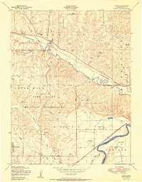
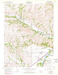
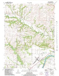
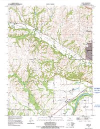
Wildcat Cr carves a deep valley through the center of this landscape, creating a topographic divide between the rural crossroads of Keats to the north and the expanding suburban reaches of Manhattan to the east. The southern edge of the map is dominated by the broad floodplain of the Kansas River, where the historic Ashland Bottoms and Eureka Lake define the river-bottom geography. This area serves as a critical transportation and institutional hub for the region, housing the Manhattan Regional Airport and the sprawling grounds of the Kansas Veterans Cem at Manhattan.
Find a feature on this map
93 named features on this map. Tap any name to fly to it.
Don’t see what you’re looking for? This feature index may not catch every label — zoom into the map to look around manually.
Map Details
Editions of this 2022 Keats Map
This is the sole edition of this map. No revisions or reprints were ever made.
Historical Maps of Eureka Lake Through Time
5 maps found