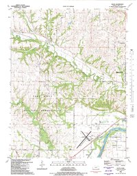
1982 Map of Keats
USGS Topo · Published 1982About this map
Keats sits at the intersection of a complex creek network and the Union Pacific rail line in this early 1980s Riley County survey. The landscape is defined by the sharp transition between the upland prairie of the Fort Riley Military Reservation and the alluvial plains of the Kansas River. Notable for local historians are the rural landmarks scattered throughout the hills, including the Vinton School and Elm Hollow Corner, which reflect the area's agricultural past before the westward expansion of Manhattan.
Find a feature on this map
38 named features on this map. Tap any name to fly to it.
Don’t see what you’re looking for? This feature index may not catch every label — zoom into the map to look around manually.
Map Details
Editions of this 1982 Keats Map
This is the sole edition of this map. No revisions or reprints were ever made.
Other maps of this area

1886 · Junction City
USGS Topo · 1:125,000

1889 · Junction City
USGS Topo · 1:125,000

1894 · Junction City
USGS Topo · 1:125,000

1947 · Manhattan
USGS Topo · 1:62,500

1947 · Fort Riley
USGS Topo · 1:62,500

1950 · Keats
USGS Topo · 1:24,000

1950 · Manhattan
USGS Topo · 1:24,000

1950 · Junction City
USGS Topo · 1:24,000

1951 · Swede Creek
USGS Topo · 1:24,000

1951 · Ogden
USGS Topo · 1:24,000