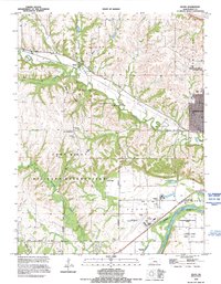
1992 Map of Keats
USGS Topo · Published 1995About this map
Wildcat Creek and its many tributaries, including Silver Creek, Kitten Creek, and Honey Creek, define the drainage patterns of this Riley County landscape. The Fort Riley Military Reservation occupies a significant portion of the southwestern quadrant, where the terrain is marked by multiple landing strips and specialized infrastructure like Engineer Road and Military Road. Near the eastern edge, the growth of Manhattan is evident, reaching toward Washington Marlatt Memorial Park.
Find a feature on this map
37 named features on this map. Tap any name to fly to it.
Don’t see what you’re looking for? This feature index may not catch every label — zoom into the map to look around manually.
Map Details
Editions of this 1992 Keats Map
This is the sole edition of this map. No revisions or reprints were ever made.
Other maps of this area

1886 · Junction City
USGS Topo · 1:125,000

1889 · Junction City
USGS Topo · 1:125,000

1894 · Junction City
USGS Topo · 1:125,000

1947 · Manhattan
USGS Topo · 1:62,500

1947 · Fort Riley
USGS Topo · 1:62,500

1950 · Keats
USGS Topo · 1:24,000

1950 · Manhattan
USGS Topo · 1:24,000

1950 · Junction City
USGS Topo · 1:24,000

1951 · Swede Creek
USGS Topo · 1:24,000

1951 · Ogden
USGS Topo · 1:24,000